Unicoi Gap to Dick’s Creek Gap On The Appalachian Trail

Mid-March is thru-hiker’s season on the Appalachian Trail. The most common schedule for anyone planning on hiking all 2,000+ miles is to start in Georgia at Springer Mountain in March and finish in Maine at Mt. Katahdin in September. You get to beat the heat of the South while also beating winter (and the closing of Mt. Katahdin) up North. It was also one of the few times in which my, my brother’s, my Dad’s, and my brother in law’s schedules all aligned for 2 days to hike another section of the Georgia Appalachian Trail. So that’s what we did.
This hike was different from our past expeditions (such as the one with the bear, the raining one, and the near-perfect one) for a few reasons. First, it was long and very strenuous. We covered 16.9 miles (ignore Google Maps estimation below) over 3 mountains, including 1 mile with more than 1000 ft elevation change.
Second, it was beautiful. Like, incredible clear skies & infinite horizons type beautiful. Our other hikes were certainly beautiful, but we never realize just how much the tree growth and limbs had been blocking our views (even though, of course the tree growth and flowers made those hikes beautiful in their own way). In March, Spring had not yet come, so we had absolutely stareworthy views the whole hike.
Third, it was crowded. An estimated 2,000 people attempt top thru-hike the Appalachian Trail every year – and the majority start out at Springer Mountain in Georgia in March. Now, the Trail is super long, and so we all had tons of time where we were completely alone while hiking. However, it did mean that we were playing leap frog with lots of hikers. There were fewer choice camp spots and all the shelters were pretty packed out. We did get to meet plenty of interesting people though. BTW, if you haven’t read Bill Bryson’s account of starting out thru-hiking in A Walk In The Woods – you should.
I have several thru-hiker friends who are all some of the most interesting people I know. It was really cool to be meeting new people all at the beginning of their project.
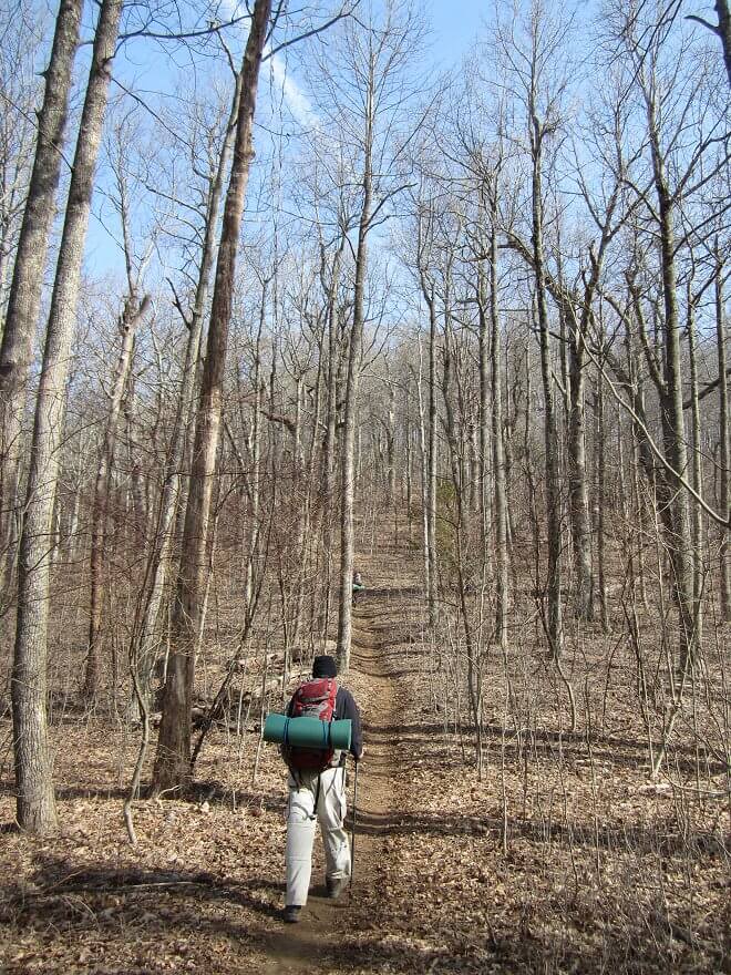
Fourth, we were prepared-ish. This was our 4th overnight hike. We’ve been learning how to overnight by trial and error (not recommended by the way), and now have the basics pretty much down. Plus, this was the first hike where we had proper equipment that we actually owned (and had fitted). Jason and I had gone to REI Atlanta to be fitted for packs (highly recommended by the way, talk to Geo). And had been given a pretty solid entry level tent so we didn’t have to rent.
We actually had water bladders instead of bulky milk jugs and gatorade bottles. We had a good sense of how much food to bring along. We had proper sleeping bags and pillows (although I will say that we will be getting better mats from REI next time).
That said, we’re still learning lots of key things by experience. Here’s what that meant for the hike – and for the section from Unicoi Gap to Dick’s Creek specifically.
Here’s a map of the Unicoi Gap to Dick’s Creek Gap section we hiked –
The Start
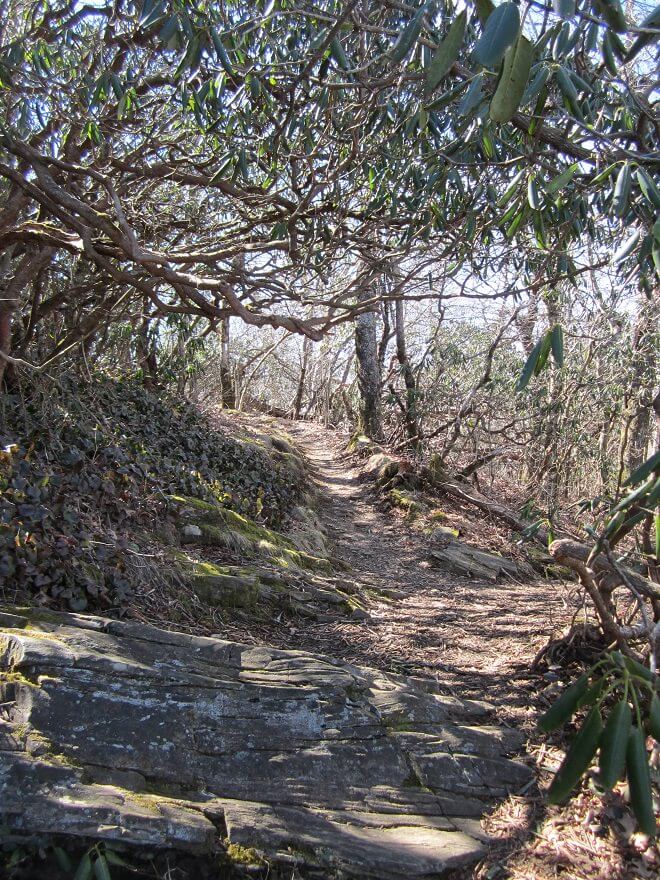
The section starts at Unicoi Gap on Georgia Highway 75 and heads straight up the memorably named Rocky Mountain. It’s a tough start with 1000+ feet in ascent within 2 miles.

Without leaves on the trees, you do have stunning views all the way up, and are greeted with a granite outcrop vista near the top.
Once you wrap around the top, you head down to Indian Grave Gap and cross over Tray Mountain Road a couple times.


It’s up and down, but a nice peaceful section. But then you start another steep 1000+ foot ascent to Tray Mountain.
Tray Mountain
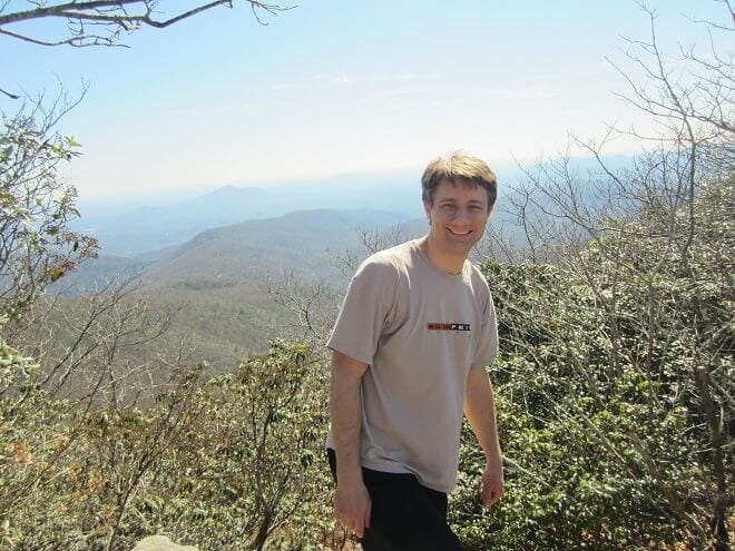
The summit of Tray Mountain never seems to come when you’re ascending, but when it does come – you know it. Because like Springer and Blood Mountain, you actually do summit it. As in, you get to the highest point marked by the US Geological Survey.
Tray Mountain isn’t bald, but it does have mainly stubbly trees, which gives you 360 degree views of North Georgia. It’s absolutely stunning and very much worth a day hike, and the tough ascent.


The northbound descent is just as rapid as the northbound ascent. There’s a spur about a half mile from the summit to the trail shelter. You cross another logging road before beginning a series of annoyingly strenuous hikes up and down gaps.
Quick Aside
At the first logging road after Tray Mountain, we came across several guys grilling and giving away hamburgers, along with all sorts of other treat & drinks. It was a really cool and welcome setup. Hiking builds an appetite and it’s tough to pack out warm food. We joined about 7 other hikers to have a burger (something I’d regret later).
It turned out the guys grilling out were a part of a local church ministry. And it turns out that Appalachian Trail ministries are sort of a thing. Not only did we encounter these guys, a bit a later we’d run across a troupe of church kids hiking the trail, along with a couple guys who were hiking the entire AT as part of trail ministry.
Then, at Dick’s Creek we ran into 2 separate church groups providing chili, hotdogs, haircuts, candy, drinks, everything else a hiker would want.

Anyway, I had no idea trail ministry was such a big thing, and was neat to see it on the trail .Groups came from as far away as Tennessee to talk to and help out thru-hikers, all of whom were super-appreciative.
While hiking with the thru-hiker wave was annoying at points, it was also really neat to see the strong sub-culture and bonds that develop among a wave of people thru-hiking – and to get a glimpse into the interesting people and experiences they have along the way.
The Camp
It was getting towards darkness after we passed the Swag of the Blue Ridge. But that campsite wasn’t set up very well, so decided to press on to Addis Gap.

It wasn’t a mistake, but the stretch was unexpectedly strenuous. The next campsite we came to was right on a ridge at Sassafras Gap. It was fine, and it had access to water (which we didn’t take advantage of without a filter).

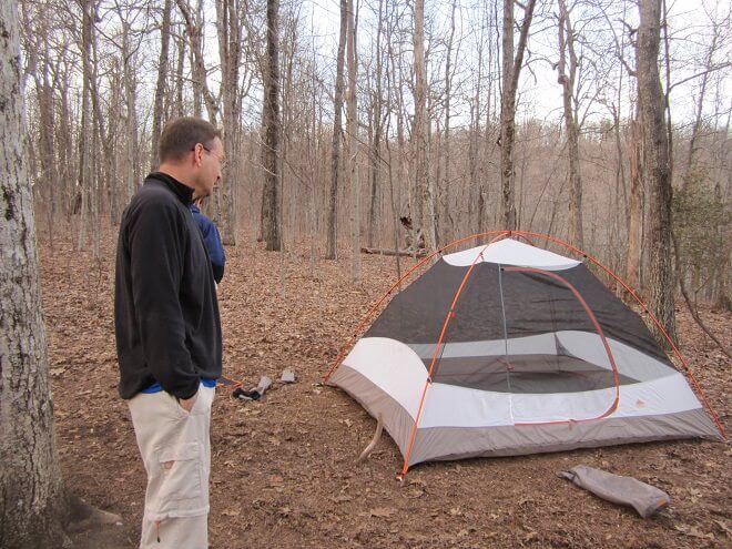

In hindsight though, camping on a ridgeline with high winds is not an optimal setup. The mountains create a sort of wind funnel effect that made camping a sub-optimal experience.
If there hadn’t been winds, the campsite would have been nice. There was a (truly) flat, rootless spot four our tent. Nice campfire spot with plenty of bear bag trees nearby. There was even a spring just down the hill.
Kelly’s Knob and Dick’s Creek
After a rough night (due to an undercooked trail ministry hamburger and high winds all night), we walked a very nice walk to Addis Gap.
After Addis Gap comes Kelly’s Knob. Now, you might expect Kelly’s Knob to be no problem at all since it’s not a “mountain.” You’d be wrong.
You’re actually talking about 1000+ foot ascent…in less than a mile. It’s tough, especially after already tackling 2 mountains and several gaps. The good and bad news is that you don’t have to actually summit Kelly’s Knob. You flip over to the other side a few hundred feet below, though you do get a nice vista at the high flip point.

The spur to Deep Gap Shelter is just a half mile or so past the flip point.
From there, it’s an up and down trail until Powell Mountain. You have a short ascent, the a long, long descent to Dick’s Creek Gap. The thing about this long, shielded descent is that it’s deceptively long. It’s a sharp enough descent to actually slow you down, so it takes a while.
Once you hit a system of streams, you’re still about a mile or so from the road. It’s a nice walk underneath large trees and overgrowth to US Highway 76 at the Dick’s Creek Gap crossing.

It’s a long, strenuous hike, but a nice distance and amazing views for an overnighter. I’d imagine it’d be a great hike in the early Fall or in May. If you’re looking for a challenging overnighter with views – then check out this section.
Lessons Learned
- Get proper elevation guides. Our guidebook only has mileage, but a +1000 ft ascent makes a difference – especially when planning a longer hike.
- Enjoy food from strangers, but verify that it’s cooked well.
- Plan water better, and always bring a water filter at least as a backup. We didn’t and were suffering for water towards the end.
- Sleeping mats matter. And as with most camping equipment, it pays to get the right kind the first go around.
- Don’t camp on a ridgeline on a windy night.
- Make sure your pillow fluffs up before hiking out.


