Dick’s Creek Gap to North Carolina / Georgia Border on The Appalachian Trail

Six years after we finished our last section (Unicoi to Dick’s Creek Gap), my brother, Dad, and I decided to come back to the Appalachian Trail and finish our last section in Georgia.
The section is a roughly 8 mile section from the trailhead at Dick’s Creek Gap on US Hwy 76 near Clayton to the North Carolina border.
Most hikers usually continue on to Bly Gap just beyond the border where there is a spur trail to a road, a large clearing and an interesting tree.
Due to time & logistics, we decided to do the hike as an out and back, camp near the border, so that we could do some hiking without packs.
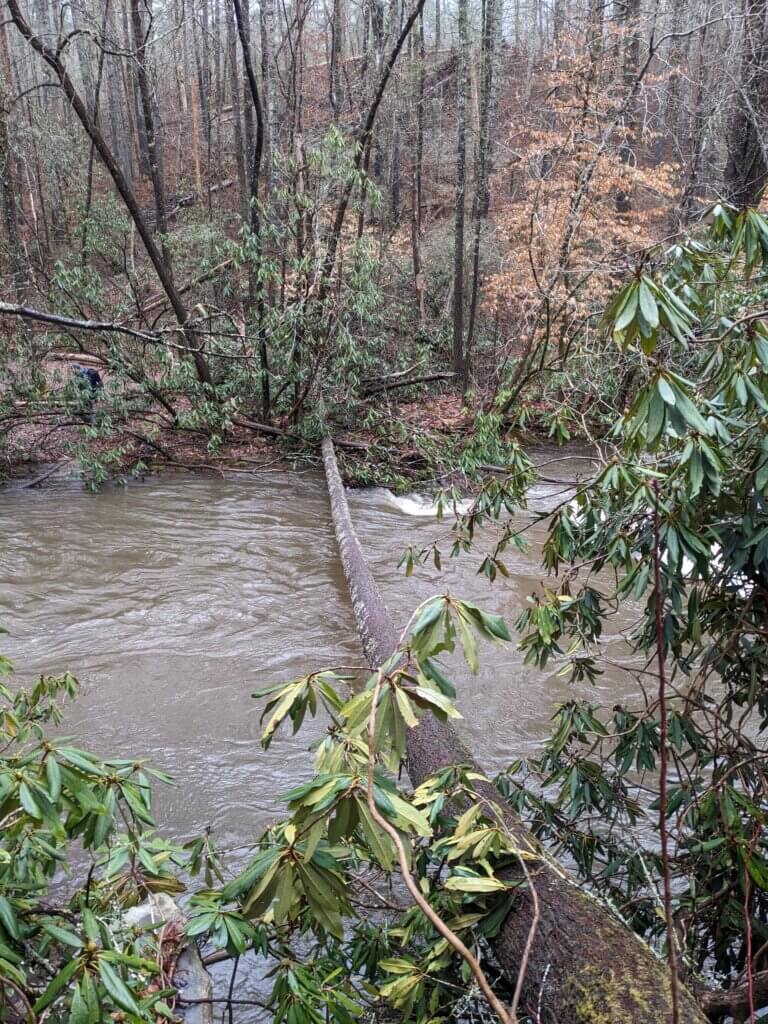
This section of the Appalachian Trail in Georgia had a lot of up and downs with only a few views. We went through mostly Pine / Oak / Hickory forest and rarely dipped down into any drainages or watersheds.

Since it was winter, there were a few views through trees and very little underbrush.

But it was mostly just walking up and down and around various knobs.
The border with Georgia and North Carolina was very anti-climactic. In fact, if we weren’t looking for it, we’d have probably missed it. It’s just a sign nailed to a tree.

Once we got to the border, we hiked back. Overall, it was a solid, nice, well-maintained section of the AT. It’s also a good path to access other parts of North Georgia that I’d like to explore – such as portions of the Southern Nantahala Wilderness.
Notes
Campsites were *very* sparse on this section. The campsites that do exist (and are recommended by large hiking sites like AtlantaTrails) have been loved to death and are almost all closed by the USFS for recovery.
The only water source and reliable camping area was at Plum Orchard Gap shelter about 4.5 miles in from Dick’s Creek Gap.
Leave No Trace / Dispersed Camping is possible, but since the trail spends almost the entire time wrapping around knobs, it’s quite a hike off-trail to anywhere that’s good. Cowart Gap has a dry camping area on a retired Forest Service Rd. But overall, I’d recommend planning a day hike or an extended hike to Deep Gap in North Carolina to push past the heavily trafficked Georgia section.
Maintenance on this section was amazing. The Georgia Appalachian Trail Club has been doing amazing work in addition to the USFS managing the heavy use during COVID-19.